Support and Documentation
Using these two tools allows to accurately measure the distance between objects and calculate the selected area directly on the map.
Measure distance between points. The “Measure distance” tool is used to calculate the distance between any points or count the length of an arbitrarily polyline.
Usage. Hover over the ruler-icon in the map toolbar and select the “Measure distance” tool. Simply click once on one point on the map, then click again on the second point. The distance should then be displayed. If necessary, add third, fourth, etc. points. You can change the position of any point or delete it anytime.
Please note that the ruler tool counts the shortest distance as a straight line. To determine the length and distance between real routes on the roads, opt for the “Route to the point” tool.
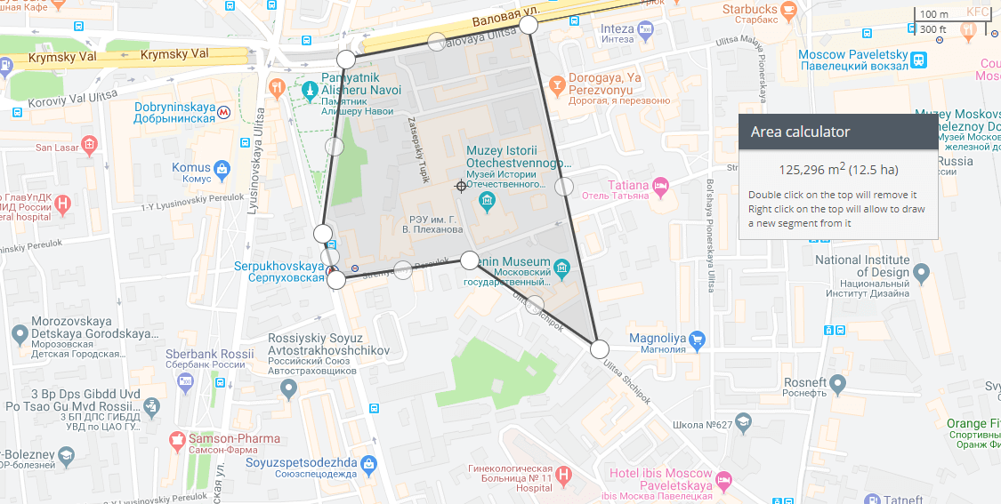
Measure the area. The “Area calculator” tool allows to measure the enclosed area of a defined polyline on the map.
Usage. Hover over the ruler-icon in the map toolbar and select the “Area calculator” tool. Indicate at least three points on the map — you will build a triangle or polygon with vertices at the chosen points. Once created, you can adjust the desired area by adding new points (from the middle of the sides of the existing polygon), drag the vertices and delete the unnecessary ones, etc.
You will see the measured data in a pop-up window next to the figure created.


